

GIS Beyond Maps - The New Dimensions in Urban Planning
Event description
How should GIS boost your planning capabilities and enhance your projects? Join us for a panel discussion that will explore how more accessible geospatial analysis can change the way practitioners, stakeholders and communities engage with the planning system.
With the push for planning practice to become more digital, the focus on the value of geospatial data is greater, alongside a renewed celebration of GIS as a technical specialism. Technological advancements have led to GIS becoming more accessible, however there are still challenges that need to be overcome to maximise the potential offered by new and evolving geospatial tools.
The 45 min panel session will consider:
Understanding geospatial data
The capabilities of geospatial analysis in urban planning, spatial modelling, and predictive analysis.
Urban analytics
How can geospatial analysis change the way we look at urban planning. From studying population changes to predicting urban growth, geospatial analysis offers valuable insights.
Education’s role
What is the role of universities and planning schools in integrating the use of geospatial data and analysis into the curriculum.
Community engagement
How can interactive tools, including maps, help involve communities in planning.
Applications beyond mapping
In what different ways geospatial data and analysis are used in various sectors, from population health to environmental impact and other applications.
The Diagonal team will lead this session, informed by insights from their experience working across built environment projects, and through moderated discussion bring in perspectives from academic and professional planning spheres.
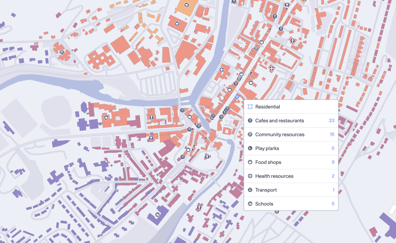
View from our tool, Skyline
The panel will include:
Adam Sheppard MRTPI FRGS FHEA
Assistant Professor of Urban Planning, Centre for Urban and Regional Studies School of Geography, Earth and Environmental Sciences University of Birmingham
Frances Summers
Part Time Lecturer of Urban Planning at University of Gloucestershire and Senior Planning Officer at Bournemouth, Christchurch and Poole Council (BCP Council)
Lucy Styles
Planning Information and Delivery Team Leader Aberdeenshire Council
Sarah Dackham
Digital Business Partner, Transformation, Innovation & Digital, Dorset Council
Gala Camacho
Data Scientist, Diagonal
We have designed the session to foster discussion around the broader capabilities of GIS, auditable data analysis, interactive data visualisation – and crucially, show how these things can impact your work positively.
Tickets for good, not greed Humanitix dedicates 100% of profits from booking fees to charity